
Top 5 Editorial Picks
Five current picks chosen for distinct deep drop needs — from a sonar-first 7-inch unit to a premium expandable system and our top electric reel. These are editorial selections, not ratings.
As an Amazon Associate, we earn from qualifying purchases.
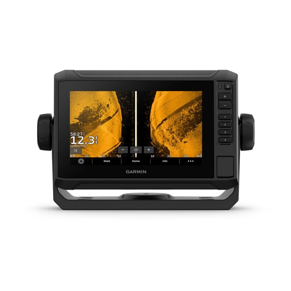
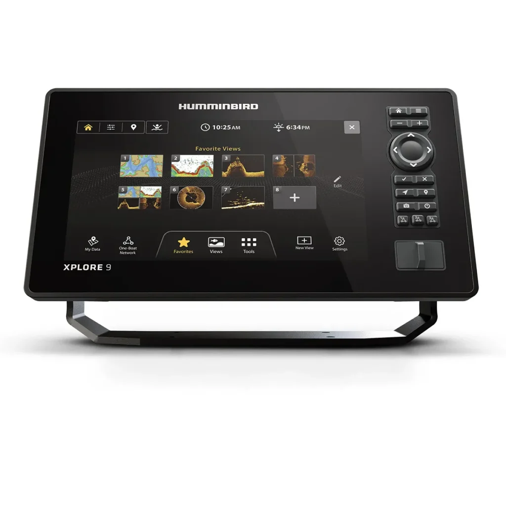
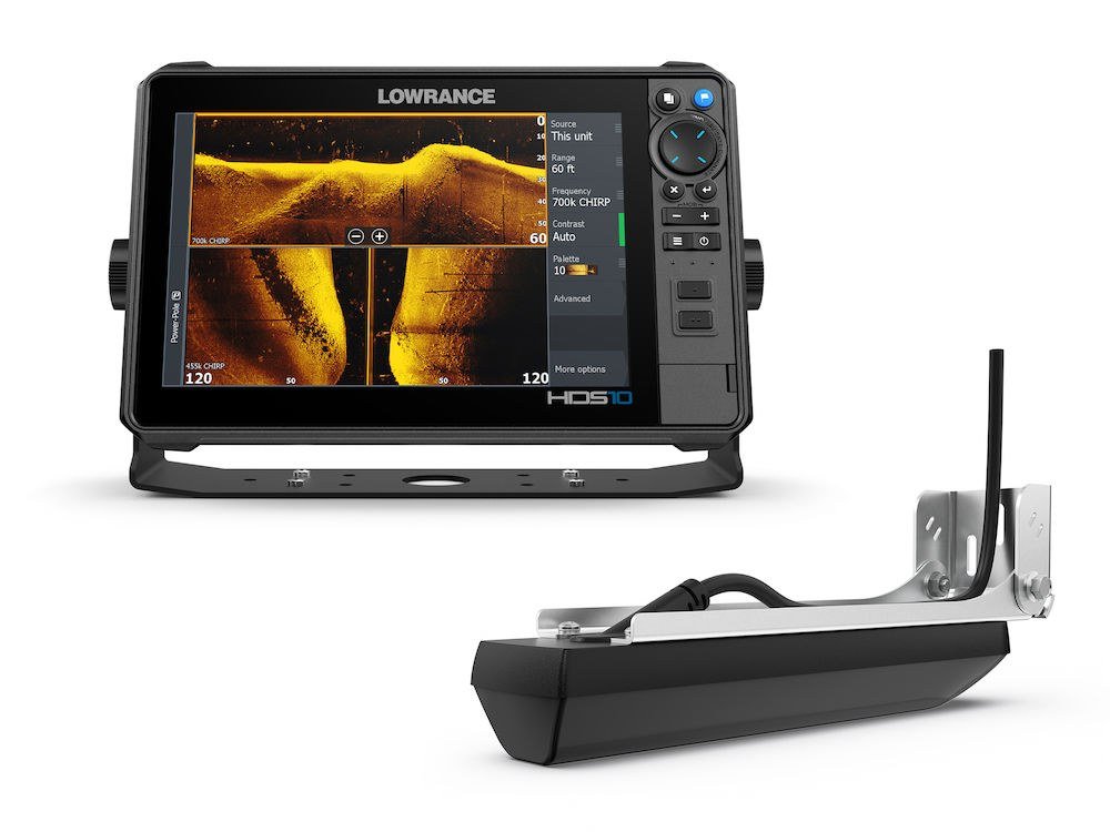
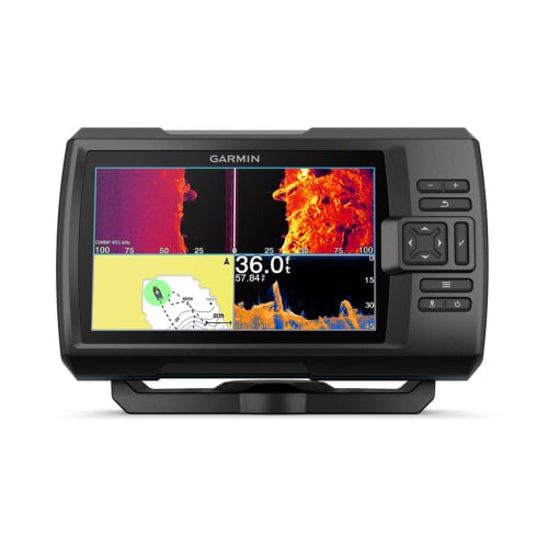
Best Marine GPS / Chartplotter for Offshore Fishing
Quick Answer: For offshore fishing, our chartplotter pick is the Humminbird XPLORE 9 — a 9-inch GPS chartplotter/fish finder with chartplotting built in, storage for 10,000 waypoints, an included basemap plus premium chart compatibility, and the networking to grow with your boat. On a tighter budget, the Garmin STRIKER Vivid 7sv gives accurate GPS positioning, waypoints and routes for much less — but it is a fish finder with GPS, not a true chartplotter, and carries no preloaded charts. Everything below is drawn from the manufacturers’ published specifications and our own published reviews.
Disclosure: DeepDropFishing.com is reader-supported. As an Amazon Associate, we earn from qualifying purchases made through links on this page — at no additional cost to you.
A note on scope: this guide compares only two units — the Humminbird XPLORE 9 and the Garmin STRIKER Vivid 7sv — because those are the units our published reviews cover. It does not rank the wider chartplotter market, and it does not claim hands-on testing. Where a specification matters to the recommendation, it is stated and attributed to the manufacturer.
What Matters Offshore
The wrong way to choose is to shop for sonar first. Sonar is the feature that sells, but offshore a chartplotter earns its place on the chart table, not on the screen that shows fish. What earns its place offshore is navigation: charts you can read, waypoints you can trust, a position you can rely on when the landmarks are gone, and a unit that will still make sense when the boat’s electronics grow. Five questions separate a good offshore tool from an expensive toy.
Screen size and readability
Offshore screens fight glare, spray and distance. You read the plotter from the helm, the cockpit, and sometimes the stern while a rod is loaded — so size and resolution matter more than at the dock. A 9-inch display at 1280 × 720, like the XPLORE 9’s, keeps chart labels, depth numbers and split-screen sonar readable at arm’s length and beyond. A 7-inch screen at 800 × 480, like the STRIKER’s, works at a small helm but asks you to lean in for fine detail. Touch control matters too: the XPLORE 9 pairs its touchscreen with a physical keypad (Cross Touch), usable with wet hands.
Chart detail: what you see before you go
This is the dividing line between the two units in this guide, and the one to get right. A chartplotter shows you published, survey-based charts of the water you are about to enter — depth contours, hazards, channels, and the shapes of reefs and wrecks you have never visited. The XPLORE 9 does this out of the box with its built-in Humminbird Basemap, and accepts premium chart cards (Lakemaster, CoastMaster and Navionics) when you want more detail. The STRIKER Vivid 7sv has no preloaded charts and no chart-card slot: its built-in world basemap is a rough outline only, and the detail you get comes from maps you draw yourself with Quickdraw Contours, up to 2 million acres at 1-foot contours. If you fish unfamiliar water, this difference alone decides the purchase.
Waypoint and route capacity
Offshore fishing runs on numbers. A wreck, a ledge, a live bottom, a line of structure you found at 2 p.m. last August — you mark it, name it, and return to it next year. Humminbird states the XPLORE 9 stores 10,000 waypoints, 50 routes, and 50,000 trackpoints: a serious library across seasons, and one that keeps a charter’s or a club’s accumulated numbers usable. The STRIKER holds 5,000 waypoints, 100 routes, 50,000 trackpoints and 200 saved tracks — more than enough for one boat’s own marks, but half the waypoint headroom. Our guide to deep drop fishing spots and charters explains why those numbers matter once you start fishing named ground.
Networking and expansion
A chartplotter should not be the last electronics purchase you make, and a good one is not: the XPLORE 9 networks over NMEA 2000, Bluetooth, Wi-Fi and Ethernet, so it can talk to trolling motors, share waypoints and sonar with other Humminbird units, and accept Ethernet-switch compatibility for larger systems. Garmin’s STRIKER Vivid 7sv is largely self-contained: Garmin’s specification lists Wi-Fi for the ActiveCaptain app — waypoint transfer, notifications and updates from your phone. Convenient, but phone connectivity is not a boat network. One helm unit on a small center console, and the difference may never touch you; networked gear in the boat’s future, and it should decide the purchase today.
GPS reliability offshore
Offshore, the water is the map — and the unit’s job is knowing exactly where it is on it. Both units offer the full satellite coverage modern anglers expect: the XPLORE 9 pairs a GPS receiver with GLONASS, while the STRIKER Vivid 7sv supports GPS, GLONASS and Galileo. Both will hold position, plot routes and navigate to waypoints. The practical difference is not the satellites: it is what the unit does with the position once it has it — the charts it can overlay, the route detail it can carry, and the waypoints it can hold. A fish finder with GPS can mark a spot. A chartplotter puts that spot in context.
Our Offshore Chartplotter Pick: Humminbird XPLORE 9
The full offshore package: real charts, a 9-inch screen, a waypoint library big enough for seasons of fishing, and room to grow.
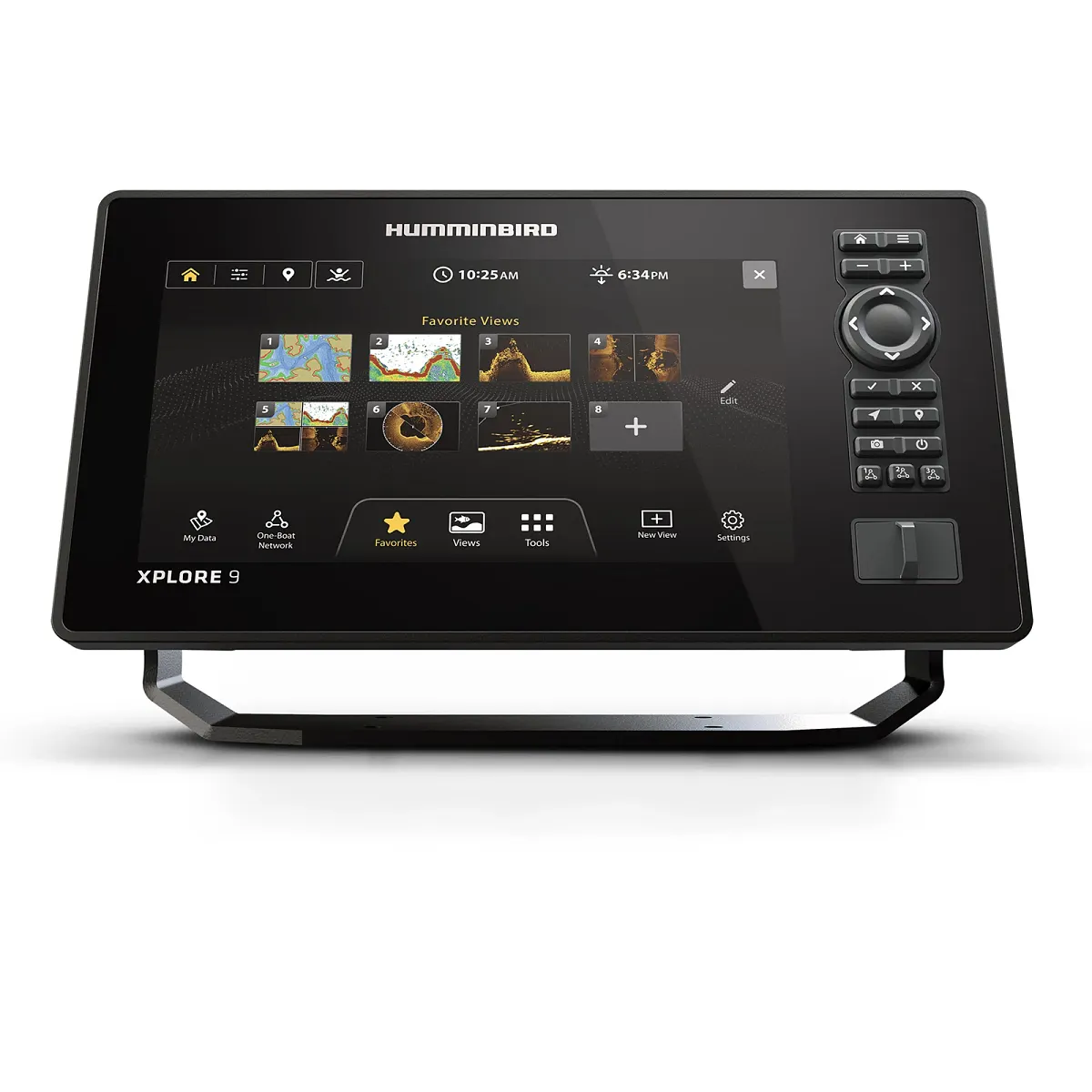
Humminbird’s XPLORE 9 is the navigation center of an offshore boat because it is built for this job first and priced as the full package second. It pairs a 9-inch touchscreen and keypad control with a genuine chartplotter: the included basemap shows depth contours and structure for the water in front of you, and premium chart cards from Lakemaster, CoastMaster and Navionics are compatible when you need finer detail.
The screen suits the job: 9 inches diagonal, 1280 × 720, full colour, worked by Cross Touch. The waypoint capacity suits an angler collecting numbers across seasons, and the networking spec — NMEA 2000, Bluetooth, Wi-Fi, Ethernet-switch compatibility — means the unit never becomes the bottleneck as the boat’s electronics grow.
The chartplotter half never travels alone: the sonar runs Dual Spectrum CHIRP with MEGA Down Imaging+ and MEGA Side Imaging+, powered by a 1,000-watt RMS output and readings to 1,200 feet in open water. The included Xplore transducer covers the depths most offshore fishing actually happens in, and the wide-angle CHIRP cone means bottom readings hold as speeds vary.
If you want the full XPLORE 9 specification set, our Humminbird XPLORE 9 review breaks down the chart options, sonar depths, and transducer coverage in full. Our best fish finder for deep drop fishing guide puts it alongside the wider field if you want a comparison point.
Key verified specifications (Item 412000-1):
- Display: 9-inch touchscreen, 1280 × 720 resolution, Cross Touch keypad included
- Waypoints: 10,000 waypoints, 50 routes, 50,000 trackpoints
- Charts: Humminbird Basemap built in; Lakemaster, CoastMaster and Navionics compatible
- Sonar: Dual Spectrum CHIRP, MEGA Down Imaging+, MEGA Side Imaging+; 1,000-watt RMS, readings to 1,200 feet
- Transducer: Xplore transducer included
- Networking: NMEA 2000, Bluetooth, Wi-Fi, Ethernet-switch compatibility
- GPS: GPS + GLONASS
Buy it if: you fish unfamiliar or offshore water, you want a true chartplotter with charts you can trust, you want a waypoint library that grows across seasons, and you want networking that leaves room for trolling motors, additional units and future upgrades.
Skip it if: your helm will not fit a 9-inch unit, your fishing is entirely familiar inshore water, or your budget will not stretch to a full chartplotter package.
Disclosure: DeepDropFishing.com is reader-supported. As an Amazon Associate, we earn from qualifying purchases made through links on this page — at no additional cost to you.
The Honest Budget Alternative: Garmin STRIKER Vivid 7sv
A fish finder with GPS, not a chartplotter — and honest about it.
Garmin’s STRIKER Vivid 7sv is the budget alternative in this guide, and the label facing forward matters: this is a fish finder with GPS positioning, not a chartplotter. The distinction is not marketing; it is the difference between navigating by a chart and navigating by your own marks. Its 7-inch, 800 × 480 display shows CHIRP and ClearVü/SideVü sonar, Quickdraw Contours mapping, and GPS positioning with waypoints and routes — all at a price far below a true chartplotter.
The honest value here is in what it does well: it is simple to install, simple to learn, and simple to trust on familiar water. Its Quickdraw Contours mapping will draw a map of the bottom you have sounded yourself — up to 2 million acres at 1-foot contours — so if you fish a home reef, a known wreck or a small patch of ground, you can build the detail you need. The trade is that it will not show you the water you have not fished yet.
Our Garmin STRIKER Vivid 7sv review covers the full specification set, the sonar suite and the mapping limits in detail.
Key verified specifications (Item 010-02552-00):
- Display: 7-inch, 800 × 480 resolution, keypad control (no touchscreen)
- Waypoints: 5,000 waypoints, 100 routes, 50,000 trackpoints, 200 saved tracks
- Charts: No preloaded charts; built-in world basemap only; no chart-card slot
- Sonar: CHIRP, ClearVü, SideVü; GT52HW-TM transducer included
- Mapping: Quickdraw Contours, up to 2 million acres at 1-foot contours
- Connectivity: Wi-Fi for ActiveCaptain app only
- GPS: GPS, GLONASS, Galileo
Buy it if: you fish familiar inshore or nearshore water, you want accurate GPS and capable sonar at the lowest sensible price, and you are happy to build your own maps with Quickdraw Contours.
Skip it if: you fish unfamiliar offshore water, you want published charts and a true chartplotter, or you want to network with other units and trolling motors later.
Decision Table: XPLORE 9 vs STRIKER Vivid 7sv
| Feature | XPLORE 9 | STRIKER Vivid 7sv |
|---|---|---|
| Type | True chartplotter | Fish finder with GPS |
| Screen | 9-inch, 1280 × 720, touchscreen + keypad | 7-inch, 800 × 480, keypad only |
| Charts | Basemap built in; Lakemaster, CoastMaster, Navionics compatible | World basemap only; no chart-card slot |
| Waypoints | 10,000 | 5,000 |
| Routes | 50 | 100 |
| Sonar | Dual Spectrum CHIRP, MEGA Down Imaging+, MEGA Side Imaging+ | CHIRP, ClearVü, SideVü |
| Transducer | Xplore included | GT52HW-TM included |
| Networking | NMEA 2000, Bluetooth, Wi-Fi, Ethernet-switch compatible | Wi-Fi (ActiveCaptain) only |
The XPLORE 9 wins every navigation row because it is the only true chartplotter here. The STRIKER wins on cost and simplicity because it never pretended to be one.
Frequently Asked Questions
Do I need a chartplotter for offshore fishing, or is a fish finder with GPS enough?
For offshore fishing, a chartplotter is the right tool. A fish finder with GPS will mark a spot and navigate you back to it, but it cannot show you published charts of unfamiliar water, hazards, channels or structure you have not yet fished. If you fish unfamiliar offshore water, you need the chart. If you fish only familiar ground, a fish finder with GPS — like the STRIKER Vivid 7sv — is enough, and you can build your own maps with Quickdraw Contours.
What size screen is best for an offshore chartplotter?
A 9-inch screen is the sensible offshore minimum when the helm allows it. At 1280 × 720, the XPLORE 9’s display keeps chart labels, depth numbers and split-screen sonar readable from the helm and beyond. A 7-inch screen at 800 × 480, like the STRIKER’s, works at a small helm, but fine chart detail asks you to lean in. If your helm will fit a 9-inch unit, buy the larger screen; if it will not, the 7-inch STRIKER is the honest compromise.
Can I use the Garmin STRIKER Vivid 7sv offshore?
Yes, with limits. The STRIKER Vivid 7sv will hold GPS position, plot routes and navigate to waypoints offshore, and its sonar suite covers CHIRP, ClearVü and SideVü. What it will not do is show you published charts of unfamiliar water: there are no preloaded charts and no chart-card slot. On familiar water, where your own marks and Quickdraw Contours maps carry the detail, it is a capable offshore fish finder. On unfamiliar water, it is a compromise, and a true chartplotter is the better buy.
What is the difference between a chartplotter and a fish finder with GPS?
A chartplotter is a navigation instrument that shows published charts: depth contours, hazards, channels and structure, surveyed and drawn for you. A fish finder with GPS is a sonar instrument with positioning: it shows the bottom below you, marks where you have been, and navigates to waypoints — but it has no published chart to put those waypoints in context. The XPLORE 9 is the former; the STRIKER Vivid 7sv is the latter.
Can I build my own charts with the STRIKER Vivid 7sv?
Yes, within limits. Quickdraw Contours lets you draw your own 1-foot contour maps of the bottom you have sounded, up to 2 million acres, and store them on the unit. What you cannot do is load a published chart of water you have not fished, or use a chart-card slot — the STRIKER has none. You are building the map yourself, one pass at a time.
The Bottom Line
For offshore fishing, buy the navigation first. The Humminbird XPLORE 9 is our pick because it is a genuine chartplotter — real charts, a 9-inch screen readable in working light, capacity for a serious waypoint library, networking that leaves room to grow — with deep-water sonar underneath. The Garmin STRIKER Vivid 7sv is the honest alternative when the budget is firm and the water familiar: accurate GPS positioning and capable sonar, clearly labelled a fish finder, not a chartplotter. Decide which of those two boats is yours, and the choice makes itself.